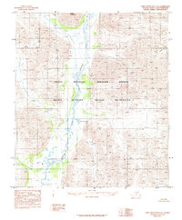
1983 Map of Table Mountain C-5
USGS Topo · Published 1984About this map
The Sheenjek River flows through the center of this remote North Slope landscape, providing a primary drainage route for the surrounding high-altitude terrain. Situated within the Arctic National Wildlife Refuge and its designated Arctic Wildlife Refuge Wilderness, the region is characterized by significant relief and undisturbed natural features. Notable landmarks include the prominent Double Mountain in the northern portion of the quadrangle and Ambresuajun Lake positioned near the riverbanks. The eastern edge of the map captures the headwaters of the Coleen River, illustrating the complex water systems that define this part of the Brooks Range foothills. This 1983 edition, based on 1974 photography, documents the area's geography before modern environmental shifts, serving as a record of its primitive state under federal protection.
Find a feature on this map
6 named features on this map. Tap any name to fly to it.
Don’t see what you’re looking for? This feature index may not catch every label — zoom into the map to look around manually.
Map Details
Editions of this 1983 Table Mountain C-5 Map
This is the sole edition of this map. No revisions or reprints were ever made.
Other maps of this area

1951 · Arctic
USGS Topo · 1:250,000

1951 · Table Mountain
USGS Topo · 1:250,000

1956 · Table Mountain
USGS Topo · 1:250,000

1956 · Arctic
USGS Topo · 1:250,000

1964 · Table Mountain
USGS Topo · 1:250,000
1972 · Table Mountain B-4
USGS Topo · 1:63,360
1972 · Table Mountain B-5
USGS Topo · 1:63,360
1983 · Table Mountain D-4
USGS Topo · 1:63,360
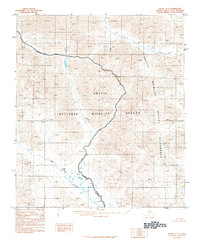
1983 · Arctic C-1
USGS Topo · 1:63,360
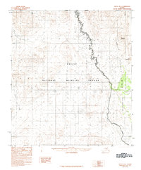
1983 · Arctic B-1
USGS Topo · 1:63,360