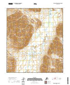
2018 Map of Table Mountain C-5 SW
USGS Topo · Published 2018About this map
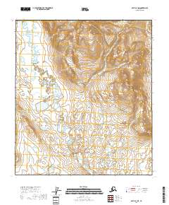
The Sheenjek River winds through this expanse of the North Slope Borough in the Brooks Range foothills. The terrain is characterized by steep elevational gradients and complex drainage patterns, where narrow valley floors give way to high ridges and summits. This 2018 survey by the U.S. Geological Survey illustrates the braided channel of the river as it moves through the southern portion of the quadrangle, creating a series of small ponds and wetlands in the low-lying basins. As a document of the modern wilderness, this map shows a landscape defined by natural boundaries and topographic relief rather than human settlement, preserving the spatial relationship between the river system and the high mountain peaks that surround it.
Find a feature on this map
2 named features on this map. Tap any name to fly to it.
Don’t see what you’re looking for? This feature index may not catch every label — zoom into the map to look around manually.
Map Details
Editions of this 2018 Table Mountain C-5 SW Map
This is the sole edition of this map. No revisions or reprints were ever made.
Other maps of this area

1951 · Arctic
USGS Topo · 1:250,000

1951 · Table Mountain
USGS Topo · 1:250,000

1956 · Table Mountain
USGS Topo · 1:250,000

1956 · Arctic
USGS Topo · 1:250,000

1964 · Table Mountain
USGS Topo · 1:250,000
1972 · Table Mountain B-5
USGS Topo · 1:63,360
1983 · Arctic C-1
USGS Topo · 1:63,360
1983 · Table Mountain C-5
USGS Topo · 1:63,360
1983 · Arctic B-1
USGS Topo · 1:63,360
2018 · Arctic B-1 NE
USGS Topo · 1:25,000