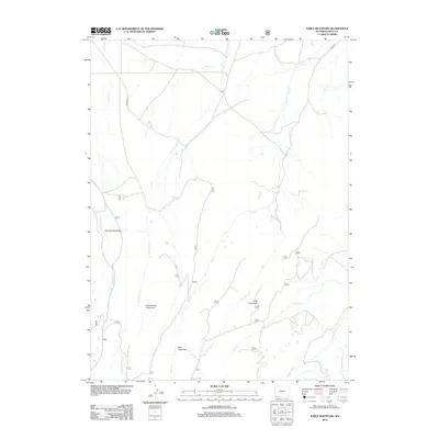
2012 Map of Table Mountain
USGS Topo · Published 2012About this map
Table Mountain and Cottonwood Mountain dominate the terrain of this Uinta County landscape, where a complex network of high-country drainages defines the geography. Early twenty-first-century water sources like Big Spring and Whiskey Spring are critical markers in this arid environment, supporting the surrounding grazing lands and meadows. The drainage patterns are clearly delineated, showing how Leavitt Cr and Cottonwood Cr flow through the western reaches, while the Henrys Fork catchment receives waters from Little Sage Cr and Louse Cr to the east. Human presence is marked primarily by ranching and resource management features, including the open expanse of Gourley Meadows and the sheltered Sage Creek Park. The map documents a sparsely populated but precisely surveyed portion of Wyoming, where local transit relies on routes like Co RD-267 and Reed RD.
Find a feature on this map
27 named features on this map. Tap any name to fly to it.
Don’t see what you’re looking for? This feature index may not catch every label — zoom into the map to look around manually.
Map Details
Editions of this 2012 Table Mountain Map
This is the sole edition of this map. No revisions or reprints were ever made.
Other maps of this area

1885 · Uinta
USGS Topo · 1:250,000

1905 · Gilbert Peak
USGS Topo · 1:125,000

1906 · Gilbert Peak
USGS Topo · 1:125,000

1954 · Salt Lake City
USGS Topo · 1:250,000

1954 · Ogden
USGS Topo · 1:250,000

1958 · Ogden
USGS Topo · 1:250,000

1958 · Salt Lake City
USGS Topo · 1:250,000

1960 · Ogden
USGS Topo · 1:250,000

1960 · Salt Lake City
USGS Topo · 1:250,000

1964 · Reed Reservoir
USGS Topo · 1:24,000