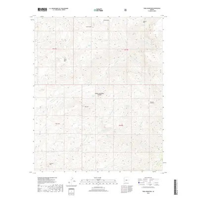
2018 Map of Table Mountain
USGS Topo · Published 2018About this map
The high desert elevations of the Tonto National Forest dominate this Maricopa County landscape, centered on the prominent plateau of Table Mountain. The terrain is defined by a series of dramatic basins and peaks, from Granite Basin and Maverick Basin in the north to Davenport Peak in the southwest. A complex drainage network of seasonal washes and creeks, such as Deadman Creek, Mazatzal Wash, and Davenport Wash, carves through the rugged topography of the Mazatzal Mountains. Isolated water sources like Willow Spring, Lost Spring, and Red Rock Spring provide critical points of interest in this arid environment. The map details the Township and Range system across T8N and T9N, reflecting the systematic surveying of this public land where Midnight Mesa stands as a notable landmark overlooking the surrounding canyons and drainages.
Find a feature on this map
31 named features on this map. Tap any name to fly to it.
Don’t see what you’re looking for? This feature index may not catch every label — zoom into the map to look around manually.
Map Details
Editions of this 2018 Table Mountain Map
This is the sole edition of this map. No revisions or reprints were ever made.
Other maps of this area

1887 · Verde
USGS Topo · 1:250,000

1892 · Verde
USGS Topo · 1:250,000

1907 · Roosevelt
USGS Topo · 1:125,000

1909 · Four Peaks
USGS Topo · 1:125,000

1912 · Roosevelt
USGS Topo · 1:125,000

1929 · Turret Peak
USGS Topo · 1:125,000

1930 · Cave Creek
USGS Topo · 1:125,000

1933 · Turret Peak
USGS Topo · 1:125,000

1936 · Payson
USGS Topo · 1:48,000

1939 · Cave Creek
USGS Topo · 1:125,000