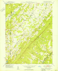
1949 Map of Table Rock
USGS Topo · Published 1949About this map
Little Backbone Mountain dominates the landscape of southern Garrett Co at the Maryland and West Virginia border, where several small agricultural and mountain communities thrived in the late 1940s. The topographic detail captures the rugged geography between Youghiogheny River and the North Branch Potomac River. Local life is anchored by social and educational hubs like Sunnyside Grange Hall, Swan Meadow Sch, and various country churches including Underwood Ch and Gnegy Ch. In the southern reaches, the Western Maryland railroad follows the winding path of the Potomac near the settlement of Wilson. Named peaks such as Table Rock, Charcoal Hill, and Conneway Hill overlook a network of tributary runs, reflecting a deeply carved plateau region where topography dictated the placement of early Bernard Road and Mason Road.
Find a feature on this map
51 named features on this map. Tap any name to fly to it.
Don’t see what you’re looking for? This feature index may not catch every label — zoom into the map to look around manually.
Map Details
Editions of this 1949 Table Rock Map
2 editions found
Other maps of this area

1886 · St. George
USGS Topo · 1:125,000

1891 · St. George
USGS Topo · 1:125,000

1895 · Piedmont
USGS Topo · 1:125,000

1899 · Oakland
USGS Topo · 1:62,500

1900 · Oakland
USGS Topo · 1:62,500

1907 · Kingwood
USGS Topo · 1:62,500

1908 · Parsons
USGS Topo · 1:62,500

1916 · Davis
USGS Topo · 1:48,000

1918 · Davis
USGS Topo · 1:62,500

1919 · Davis
USGS Topo · 1:62,500