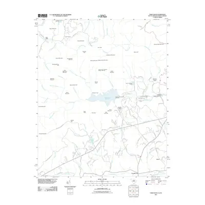
2011 Map of Table Rock
USGS Topo · Published 2011About this map
The Table Rock Reservoir dominates the landscape of this region along the border of North and South Carolina, serving as a central catchment for numerous mountain streams like Slicking Creek and Matthews Creek. The terrain is defined by dramatic elevations and geological features, including the iconic granite dome of Table Rock and the nearby The Stool, alongside Caesars Head Mountain to the northeast. Human settlement is concentrated in the lower elevations to the south and east, where small communities such as Pumpkintown, Lakemont, and Liberia are located.
Find a feature on this map
138 named features on this map. Tap any name to fly to it.
Don’t see what you’re looking for? This feature index may not catch every label — zoom into the map to look around manually.
Map Details
Editions of this 2011 Table Rock Map
This is the sole edition of this map. No revisions or reprints were ever made.
Other maps of this area

1888 · Pickens
USGS Topo · 1:125,000

1894 · Pickens
USGS Topo · 1:125,000

1905 · Pisgah
USGS Topo · 1:125,000

1906 · Pisgah
USGS Topo · 1:125,000

1935 · Brevard
USGS Topo · 1:24,000

1935 · Eastatoe Gap
USGS Topo · 1:24,000

1935 · Standingstone Mtn.
USGS Topo · 1:24,000

1935 · Rosman
USGS Topo · 1:24,000

1935 · Table Rock
USGS Topo · 1:24,000
1945 · Brevard
USGS Topo · 1:24,000