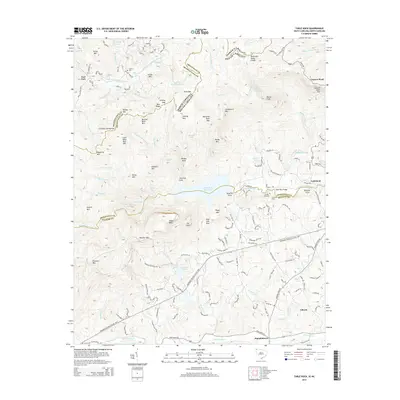
2014 Map of Table Rock
USGS Topo · Published 2014About this map
The Tennessee Valley Divide snakes through this high-elevation landscape where the Middle Saluda River and S Saluda River carve deep into the Blue Ridge. The area's hydrology is dominated by the Table Rock Reservoir, which sits south of distinctive landmarks like Table Rock and The Stool. Movement through these gaps and coves is defined by the winding Cherokee Foothills Scenic Hwy, which connects small rural communities such as Pumpkintown and Liberia.
Find a feature on this map
132 named features on this map. Tap any name to fly to it.
Don’t see what you’re looking for? This feature index may not catch every label — zoom into the map to look around manually.
Map Details
Editions of this 2014 Table Rock Map
This is the sole edition of this map. No revisions or reprints were ever made.
Other maps of this area

1888 · Pickens
USGS Topo · 1:125,000

1894 · Pickens
USGS Topo · 1:125,000

1905 · Pisgah
USGS Topo · 1:125,000

1906 · Pisgah
USGS Topo · 1:125,000

1935 · Brevard
USGS Topo · 1:24,000

1935 · Eastatoe Gap
USGS Topo · 1:24,000

1935 · Standingstone Mtn.
USGS Topo · 1:24,000

1935 · Rosman
USGS Topo · 1:24,000

1935 · Table Rock
USGS Topo · 1:24,000
1945 · Brevard
USGS Topo · 1:24,000