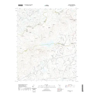
2020 Map of Table Rock
USGS Topo · Published 2020About this map
Table Rock State Park anchors this South Carolina landscape, dominated by the massive granite outcrops of Table Rock and The Stool. The terrain is defined by the Blue Ridge escarpment, where the Tennessee Valley Divide separates waters flowing toward the French Broad River from those feeding the S Saluda River. In the valley below the peaks, the Table Rock Reservoir and Pinnacle Lake provide significant water resources, while the South Saluda River flows toward the settlement of Lakemont. Local history is preserved in sites like the Saluda Hill Baptist Church Graveyard and Masters Cem. The map illustrates a transition from the high elevations of Caesars Head and Slicking Mtn down to the rural community of Pumpkintown near the Oolenoy River, showing a complex network of mountain roads such as Rockcrest Ridge Rd and Country Creek Dr.
Find a feature on this map
156 named features on this map. Tap any name to fly to it.
Don’t see what you’re looking for? This feature index may not catch every label — zoom into the map to look around manually.
Map Details
Editions of this 2020 Table Rock Map
This is the sole edition of this map. No revisions or reprints were ever made.
Other maps of this area

1888 · Pickens
USGS Topo · 1:125,000

1894 · Pickens
USGS Topo · 1:125,000

1905 · Pisgah
USGS Topo · 1:125,000

1906 · Pisgah
USGS Topo · 1:125,000

1935 · Brevard
USGS Topo · 1:24,000

1935 · Eastatoe Gap
USGS Topo · 1:24,000

1935 · Standingstone Mtn.
USGS Topo · 1:24,000

1935 · Rosman
USGS Topo · 1:24,000

1935 · Table Rock
USGS Topo · 1:24,000
1945 · Brevard
USGS Topo · 1:24,000