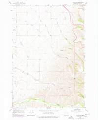
1966 Map of Table Rock
USGS Topo · Published 1978About this map
The Umatilla Indian Reservation Boundary defines the western edge of this landscape, where the plateaus of the Table Land give way to a complex system of drainages. Dominating the eastern topography is Table Rock, a prominent high point overlooking the deep incisions of North Coyote Canyon and South Coyote Canyon. The 1974 revisions, marked in purple, show the expansion of transit and land use, including a Landing Strip in the northwest and various Jeep Trails that penetrate the upland areas. This map documents a period of transition for the region’s water management, noted by numerous Spring labels and the winding path of McKay Creek along the southern border. The presence of a Cem and a Quarry indicates localized settlement and industry within this rural Umatilla County expanse.
Find a feature on this map
19 named features on this map. Tap any name to fly to it.
Don’t see what you’re looking for? This feature index may not catch every label — zoom into the map to look around manually.
Map Details
Editions of this 1966 Table Rock Map
2 editions found
Other maps of this area

1935 · Pendleton
USGS Topo · 1:125,000

1953 · Pendleton
USGS Topo · 1:250,000

1956 · Pendleton
USGS Topo · 1:250,000

1966 · Cabbage Hill
USGS Topo · 1:24,000

1966 · Mc Kay Reservoir
USGS Topo · 1:24,000
1966 · Cayuse
USGS Topo · 1:24,000

1966 · Table Rock
USGS Topo · 1:24,000

1966 · Pendleton
USGS Topo · 1:24,000

1966 · Mission
USGS Topo · 1:24,000
1967 · Bassey Creek
USGS Topo · 1:24,000