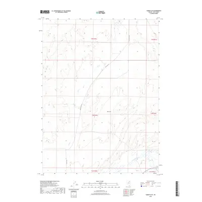
2018 Map of Tabor Flats
USGS Topo · Published 2018About this map
Tabor Flats serves as the central geographic feature of this Elko County landscape, defined by a sparse network of roads and drainages. The Humboldt River flows through the southern reaches of the quadrangle, where it is joined by Bishop Cr and Trout Cr. The convergence of these watercourses amidst the basin terrain illustrates the hydrology of the high desert, providing a crucial water source in an otherwise arid region.
Find a feature on this map
14 named features on this map. Tap any name to fly to it.
Don’t see what you’re looking for? This feature index may not catch every label — zoom into the map to look around manually.
Map Details
Editions of this 2018 Tabor Flats Map
This is the sole edition of this map. No revisions or reprints were ever made.
Other maps of this area

1955 · Wells
USGS Topo · 1:250,000

1958 · Wells
USGS Topo · 1:250,000

1961 · Wells
USGS Topo · 1:250,000

1967 · Black Butte SW
USGS Topo · 1:24,000

1967 · Black Butte
USGS Topo · 1:24,000

1967 · Hot Springs Creek
USGS Topo · 1:24,000

1967 · Welcome
USGS Topo · 1:24,000

1967 · Twin Buttes
USGS Topo · 1:24,000

1967 · Herder Creek
USGS Topo · 1:24,000
1967 · Deeth
USGS Topo · 1:24,000