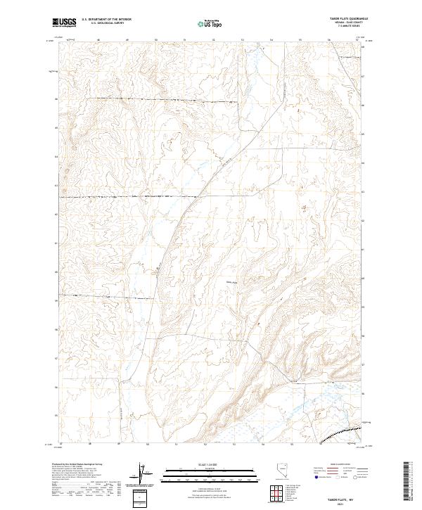
2021 Map of Tabor Flats
USGS Topo · Published 2021About this map
Tabor Flats defines the central landscape of this Elko County region, where the high desert terrain transitions into a complex drainage network feeding the Humboldt River. The map captures a critical water junction where Tabor Cr, Bishop Cr, and Trout Cr converge at the southern edge of the flats. This hydrological pattern dictated the early path of travel through the basin, evidenced by the persistent routes of the Oneil-Deeth Rd and Oneil Basin Rd. These corridors follow the natural contours of the land, avoiding the seasonal wetlands and marshy segments along the riverbanks. The detailed township and range grids, including t38n r60e and t39n r60e, show how the public land survey system partitioned this open range for ranching and resource management in the late twentieth and early twenty-first centuries.
Find a feature on this map
14 named features on this map. Tap any name to fly to it.
Don’t see what you’re looking for? This feature index may not catch every label — zoom into the map to look around manually.
Map Details
Editions of this 2021 Tabor Flats Map
This is the sole edition of this map. No revisions or reprints were ever made.
Other maps of this area

1955 · Wells
USGS Topo · 1:250,000

1958 · Wells
USGS Topo · 1:250,000

1961 · Wells
USGS Topo · 1:250,000

1967 · Black Butte SW
USGS Topo · 1:24,000

1967 · Black Butte
USGS Topo · 1:24,000

1967 · Hot Springs Creek
USGS Topo · 1:24,000

1967 · Welcome
USGS Topo · 1:24,000

1967 · Twin Buttes
USGS Topo · 1:24,000

1967 · Herder Creek
USGS Topo · 1:24,000
1967 · Deeth
USGS Topo · 1:24,000