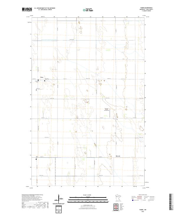
2022 Map of Tabor
USGS Topo · Published 2022About this map
The agricultural landscape of Polk County is defined here by the rectilinear grid of the Public Land Survey System, where sections are divided by local routes like 360th Ave NW and Co Hwy 23. The small settlement of Tabor serves as a local focal point, notable for its concentration of historic burial grounds including the Presbyterian Cem, Tabor Cem, and the Holy Trinity Catholic Cem. This clustering of cemeteries suggests a community built on diverse denominational roots in the Minnesota prairie.
Find a feature on this map
31 named features on this map. Tap any name to fly to it.
Don’t see what you’re looking for? This feature index may not catch every label — zoom into the map to look around manually.
Map Details
Editions of this 2022 Tabor Map
This is the sole edition of this map. No revisions or reprints were ever made.
Other maps of this area

1918 · Angus
USGS Topo · 1:62,500

1918 · Warren
USGS Topo · 1:62,500

1952 · Grand Forks
USGS Topo · 1:250,000

1952 · Thief River Falls
USGS Topo · 1:250,000

1953 · Crookston
USGS Topo · 1:62,500

1955 · Warren
USGS Topo · 1:62,500

1956 · Thief River Falls
USGS Topo · 1:250,000

1956 · Grand Forks
USGS Topo · 1:250,000

1957 · Thief River Falls
USGS Topo · 1:250,000
1961 · Angus
USGS Topo · 1:24,000