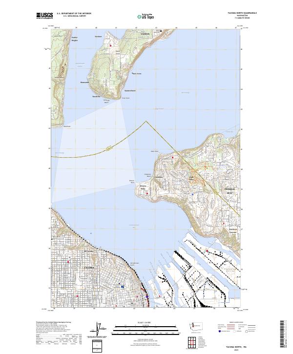
2023 Map of Tacoma North
USGS Topo · Published 2023About this map
The industrialized waterfront of Commencement Bay meets the southern tip of the Vashon-Maury landmass in this detailed mapping of the South Sound. The city of Tacoma is defined by its intricate network of maritime infrastructure, including the Thea Foss Waterway, Blair Waterway, and Hylebos Waterway, which carve deep into the Puyallup Valley. On the high ground, the University of Puget Sound and the Pierce County Courthouse anchor the urban core, while Old Tacoma and Northeast Tacoma show the residential expansion along the coast. To the north, across the Dalco Passage, the rural character of Vashon Island is preserved in settlements like Dockton and Manzanita. This layout illustrates the distinct separation between the intensive industrial shipping lanes of the harbor and the isolated residential enclaves of the islands.
Find a feature on this map
92 named features on this map. Tap any name to fly to it.
Don’t see what you’re looking for? This feature index may not catch every label — zoom into the map to look around manually.
Map Details
Editions of this 2023 Tacoma North Map
This is the sole edition of this map. No revisions or reprints were ever made.
Other maps of this area

1897 · Tacoma
USGS Topo · 1:125,000

1900 · Tacoma
USGS Topo · 1:125,000

1940 · Anderson Island
USGS Topo · 1:62,500

1941 · Tacoma South
USGS Topo · 1:62,500

1942 · Gig Harbor
USGS Topo · 1:62,500

1943 · Gig Harbor
USGS Topo · 1:62,500

1944 · Tacoma South
USGS Topo · 1:62,500

1948 · Anderson Island
USGS Topo · 1:62,500

1948 · Steilacoom
USGS Topo · 1:24,000

1949 · Tacoma North
USGS Topo · 1:24,000