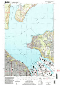
1997 Map of Tacoma North
USGS Topo · Published 2003About this map
The industrial heart of Tacoma and its deep-water terminals dominate this late 1990s survey, illustrating the complex maritime infrastructure of Commencement Bay. The heavy rail lines of the Milwaukee Road and a dense network of waterways, including the Blair Waterway and Sitcum Waterway, reveal the area's role as a major Pacific Northwest logistics hub. On the opposite shore, the map details the residential and recreational character of Browns Point and Dash Point, where the Dash Point Lighthouse stands as a sentinel at the entrance to the East Passage.
Find a feature on this map
74 named features on this map. Tap any name to fly to it.
Don’t see what you’re looking for? This feature index may not catch every label — zoom into the map to look around manually.
Map Details
Editions of this 1997 Tacoma North Map
This is the sole edition of this map. No revisions or reprints were ever made.
Other maps of this area

1897 · Tacoma
USGS Topo · 1:125,000

1900 · Tacoma
USGS Topo · 1:125,000

1940 · Anderson Island
USGS Topo · 1:62,500

1941 · Tacoma South
USGS Topo · 1:62,500

1942 · Gig Harbor
USGS Topo · 1:62,500

1943 · Gig Harbor
USGS Topo · 1:62,500

1944 · Tacoma South
USGS Topo · 1:62,500

1948 · Anderson Island
USGS Topo · 1:62,500

1948 · Steilacoom
USGS Topo · 1:24,000

1949 · Tacoma North
USGS Topo · 1:24,000