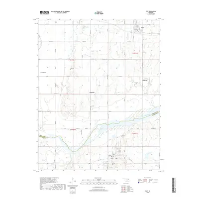
2018 Map of Taft
USGS Topo · Published 2018About this map
The Arkansas River winds across this landscape where the borders of Wagoner and Muskogee counties meet. This area reflects a long history of small communities situated along the fertile bottomlands, most notably Taft, a historically significant town with streets named for leaders and pioneers such as Martin Luther King and Choctaw. The settlement pattern is defined by these rural clusters, including Porter to the north and Yahola to the southwest, connected by a network of sectional roads like Old Taft Rd.
Find a feature on this map
51 named features on this map. Tap any name to fly to it.
Don’t see what you’re looking for? This feature index may not catch every label — zoom into the map to look around manually.
Map Details
Editions of this 2018 Taft Map
This is the sole edition of this map. No revisions or reprints were ever made.
Other maps of this area

1896 · Okmulgee
USGS Topo · 1:125,000

1900 · Okmulgee
USGS Topo · 1:125,000

1901 · Muscogee
USGS Topo · 1:125,000

1905 · Muscogee
USGS Topo · 1:125,000

1946 · Fort Smith
USGS Topo · 1:250,000

1948 · Keefeton
USGS Topo · 1:62,500

1948 · Wagoner
USGS Topo · 1:62,500

1950 · Keefeton
USGS Topo · 1:62,500

1950 · Wagoner
USGS Topo · 1:62,500
1963 · Red Bird
USGS Topo · 1:24,000