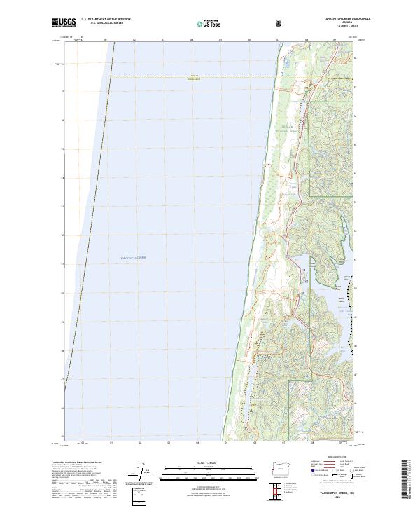
2024 Map of Tahkenitch Creek
USGS Topo · Published 2024About this map
The Siuslaw National Forest meets the Pacific shore in this coastal survey, where the landscape is defined by a dense network of freshwater lakes separated from the ocean by shifting sands like the Garter Dunes. This environment is characterized by large, irregularly shaped water bodies including Tahkenitch Lake, which features several named interior landmarks such as Weed Island, Jewitt Island, and the sheltered Cleves Cove. These lakes are fed and drained by short, coastal waterways like Tahkenitch Creek and Carter Lake Creek, which navigate the complex topography of the dunes.
Find a feature on this map
41 named features on this map. Tap any name to fly to it.
Don’t see what you’re looking for? This feature index may not catch every label — zoom into the map to look around manually.
Map Details
Editions of this 2024 Tahkenitch Creek Map
This is the sole edition of this map. No revisions or reprints were ever made.
Other maps of this area

1920 · Siltcoos Lake
USGS Topo · 1:62,500

1923 · Reedsport
USGS Topo · 1:62,500

1941 · Siltcoos Lake
USGS Topo · 1:62,500

1942 · Siltcoos Lake
USGS Topo · 1:62,500

1942 · Reedsport
USGS Topo · 1:62,500

1954 · Coos Bay
USGS Topo · 1:250,000
1956 · Reedsport
USGS Topo · 1:62,500
1956 · Siltcoos Lake
USGS Topo · 1:62,500

1958 · Coos Bay
USGS Topo · 1:250,000

1962 · Coos Bay
USGS Topo · 1:250,000