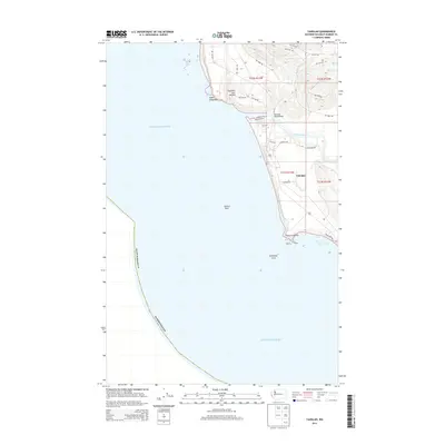
2014 Map of Taholah
USGS Topo · Published 2014About this map
Taholah serves as the focal point of this coastal landscape, situated where the Quinault River meets the Pacific Ocean. This 2014 survey documents the road network of the Quinault Indian Reservation, including Quinault St and Aalis Dr, which connect the settlement to the surrounding timberlands. The geography is defined by prominent coastal landmarks like Point Grenville and Cape Elizabeth, which frame Grenville Bay.
Find a feature on this map
34 named features on this map. Tap any name to fly to it.
Don’t see what you’re looking for? This feature index may not catch every label — zoom into the map to look around manually.
Map Details
Editions of this 2014 Taholah Map
This is the sole edition of this map. No revisions or reprints were ever made.
Other maps of this area

1938 · Moclips
USGS Topo · 1:62,500

1941 · Moclips
USGS Topo · 1:62,500

1943 · Copalis Beach
USGS Topo · 1:250,000

1951 · Copalis Beach
USGS Topo · 1:250,000

1955 · Taholah
USGS Topo · 1:62,500

1955 · Macafee Hill
USGS Topo · 1:62,500
1955 · Moclips
USGS Topo · 1:24,000

1957 · Copalis Beach
USGS Topo · 1:250,000

1963 · Copalis Beach
USGS Topo · 1:250,000
1980 · Copalis Beach
USGS Topo · 1:100,000