
1968 Map of Taiban
USGS Topo · Published 1971About this map
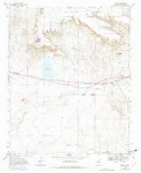
The sharp escarpment of The Cap Rock dominates this high plains landscape, separating the elevated Taiban Mesa from the lower drainage of Taiban Creek. The settlement of Taiban serves as the focal point for this ranching and transport corridor, situated where the Atchison Topeka and Santa Fe railroad crosses the plains. This late-1960s survey illustrates a region defined by its critical water sources, from the natural flow at Taiban Spring and Dripping Spring to man-made infrastructure like the North Bonner Well and Frank Windmill.
Find a feature on this map
22 named features on this map. Tap any name to fly to it.
Don’t see what you’re looking for? This feature index may not catch every label — zoom into the map to look around manually.
Map Details
Editions of this 1968 Taiban Map
2 editions found
Other maps of this area

1954 · Fort Sumner
USGS Topo · 1:250,000

1954 · Clovis
USGS Topo · 1:250,000

1958 · Fort Sumner
USGS Topo · 1:250,000

1958 · Clovis
USGS Topo · 1:250,000

1968 · Lomas Gatos
USGS Topo · 1:24,000

1968 · Fort Sumner East
USGS Topo · 1:24,000

1968 · Candy Mesa
USGS Topo · 1:24,000

1968 · Bonner Lake
USGS Topo · 1:24,000

1968 · Twin Mesa
USGS Topo · 1:24,000

1973 · Tolar
USGS Topo · 1:24,000