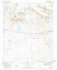
1968 Map of Taiban
USGS Topo · Published 1982About this map
Taiban Mesa and the striking escarpment of The Cap Rock dominate this high-plains landscape in De Baca County. During the late 1960s, the small settlement of Taiban remained a key point on the Atchison Topeka and Santa Fe railroad line, which cuts horizontally across the terrain alongside U.S. Route 60 84. The map reveals a land defined by water scarcity and ranching, where scattered landmarks like Dripping Spring, Taiban Spring, and the Frank Windmill represent vital infrastructure for livestock and survival. To the west, the basin of Red Lake provides a natural contrast to the surrounding mesas. Genealogists and local historians can find specific points of interest such as Doyle Ranch, East Camp, and the Taiban Cem, alongside more obscure industrial markers like a Gravel Pit and a Drill Hole near the mesa edge.
Find a feature on this map
21 named features on this map. Tap any name to fly to it.
Don’t see what you’re looking for? This feature index may not catch every label — zoom into the map to look around manually.
Map Details
Editions of this 1968 Taiban Map
2 editions found
Other maps of this area

1954 · Fort Sumner
USGS Topo · 1:250,000

1954 · Clovis
USGS Topo · 1:250,000

1958 · Fort Sumner
USGS Topo · 1:250,000

1958 · Clovis
USGS Topo · 1:250,000

1968 · Lomas Gatos
USGS Topo · 1:24,000

1968 · Fort Sumner East
USGS Topo · 1:24,000

1968 · Candy Mesa
USGS Topo · 1:24,000

1968 · Taiban
USGS Topo · 1:24,000

1968 · Bonner Lake
USGS Topo · 1:24,000

1968 · Twin Mesa
USGS Topo · 1:24,000