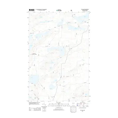
2013 Map of Tait Lake
USGS Topo · Published 2013About this map
Superior National Forest encompasses this glacial landscape, characterized by a dense network of lakes and waterways. The map highlights the connectivity between bodies of water like Tait Lake and Cascade Lake, with the Tait River and Mississippi Cr providing natural drainage through the timberland. High elevations are punctuated by names such as Hilly Lake and Lake Gust, while a limited road network consisting of The Grade and Brule Lake Rd suggests a remote character focused on forestry and recreation. The placement of forest routes like Forest Rte 331 and S Caps Trl reflects the modern management of this wilderness area. Significant water bodies such as Mistletoe Lake, Williams Lake, and Lake Clara dominate the southern half of the sheet, illustrating the lake-heavy geography typical of northeastern Minnesota.
Find a feature on this map
37 named features on this map. Tap any name to fly to it.
Don’t see what you’re looking for? This feature index may not catch every label — zoom into the map to look around manually.
Map Details
Editions of this 2013 Tait Lake Map
This is the sole edition of this map. No revisions or reprints were ever made.
Other maps of this area

1919 · Brule Lake
USGS Topo · 1:62,500

1919 · Lutsen
USGS Topo · 1:62,500

1954 · Two Harbors
USGS Topo · 1:250,000

1955 · Tofte
USGS Topo · 1:62,500

1957 · Two Harbors
USGS Topo · 1:250,000

1958 · Two Harbors
USGS Topo · 1:250,000

1958 · Deer Yard Lake
USGS Topo · 1:24,000

1959 · Lutsen
USGS Topo · 1:24,000

1960 · Tait Lake
USGS Topo · 1:24,000

1960 · Mark Lake
USGS Topo · 1:24,000