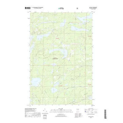
2019 Map of Tait Lake
USGS Topo · Published 2019About this map
Superior National Forest defines the character of this 2019 survey, where the glacial landscape is dominated by a dense network of water bodies and recreational trails. Central to the map is Tait Lake, supported by the Tait Lake Boat Landing and surrounded by a web of forest access routes including The Grade, Caribou Trail, and the Pike Lake Loop. The drainage patterns are clearly visible through the Tait River and Mississippi Creek, which connect numerous smaller basins like Mistletoe Lake and Roast Lake.
Find a feature on this map
36 named features on this map. Tap any name to fly to it.
Don’t see what you’re looking for? This feature index may not catch every label — zoom into the map to look around manually.
Map Details
Editions of this 2019 Tait Lake Map
This is the sole edition of this map. No revisions or reprints were ever made.
Other maps of this area

1919 · Brule Lake
USGS Topo · 1:62,500

1919 · Lutsen
USGS Topo · 1:62,500

1954 · Two Harbors
USGS Topo · 1:250,000

1955 · Tofte
USGS Topo · 1:62,500

1957 · Two Harbors
USGS Topo · 1:250,000

1958 · Two Harbors
USGS Topo · 1:250,000

1958 · Deer Yard Lake
USGS Topo · 1:24,000

1959 · Lutsen
USGS Topo · 1:24,000

1960 · Tait Lake
USGS Topo · 1:24,000

1960 · Mark Lake
USGS Topo · 1:24,000