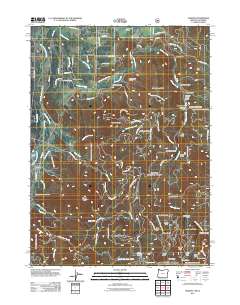
2011 Map of Takilma
USGS Topo · Published 2011About this map
Takilma and the surrounding Josephine County mountains define this study of southwest Oregon's resource-rich landscape. The settlement patterns follow a network of steep drainages, where the heritage of mining is etched into the terrain through names like Ramsey Mine, Frog Pond Mine, and Ponyshoe Mine. These sites sit alongside numerous named gulches such as Hydraulic Gulch and Deadman Gulch, pointing to a history of hydraulic operations and early prospector movements.
Find a feature on this map
81 named features on this map. Tap any name to fly to it.
Don’t see what you’re looking for? This feature index may not catch every label — zoom into the map to look around manually.
Map Details
Editions of this 2011 Takilma Map
This is the sole edition of this map. No revisions or reprints were ever made.
Other maps of this area

1908 · Grants Pass
USGS Topo · 1:125,000

1914 · Seiad
USGS Topo · 1:125,000

1917 · Kerby
USGS Topo · 1:125,000

1918 · Kerby
USGS Topo · 1:125,000

1922 · Preston Peak
USGS Topo · 1:125,000

1922 · Seiad
USGS Topo · 1:125,000

1945 · Kerby
USGS Topo · 1:125,000

1948 · Weed
USGS Topo · 1:250,000

1950 · Weed
USGS Topo · 1:250,000

1954 · Cave Junction
USGS Topo · 1:62,500