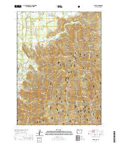
2020 Map of Takilma
USGS Topo · Published 2020About this map
The East Fork Illinois River carves through this corner of Josephine County, defining a landscape marked by the dense drainage networks of the Siskiyou National Forest and Klamath National Forest. In the southern portion of the Illinois Valley, the settlement of Takilma and the smaller community of Bridgeview serve as anchor points for a network of forest roads like Happy Camp Rd and Waldo Rd. These routes provide access to a rugged interior characterized by numerous gulches and prominent peaks such as Elder Mtn and Mt Hope.
Find a feature on this map
78 named features on this map. Tap any name to fly to it.
Don’t see what you’re looking for? This feature index may not catch every label — zoom into the map to look around manually.
Map Details
Editions of this 2020 Takilma Map
This is the sole edition of this map. No revisions or reprints were ever made.
Other maps of this area

1908 · Grants Pass
USGS Topo · 1:125,000

1914 · Seiad
USGS Topo · 1:125,000

1917 · Kerby
USGS Topo · 1:125,000

1918 · Kerby
USGS Topo · 1:125,000

1922 · Preston Peak
USGS Topo · 1:125,000

1922 · Seiad
USGS Topo · 1:125,000

1945 · Kerby
USGS Topo · 1:125,000

1948 · Weed
USGS Topo · 1:250,000

1950 · Weed
USGS Topo · 1:250,000

1954 · Cave Junction
USGS Topo · 1:62,500