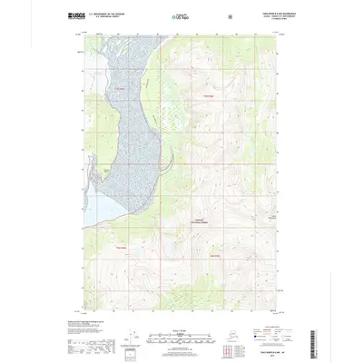
2017 Map of Taku River B-6 NW
USGS Topo · Published 2017About this map
The Tongass National Forest dominates this Alaskan landscape, where the massive Hole-in-the-Wall Glacier moves through the terrain. The map captures a rugged intersection of ice and elevation, punctuated by the Coast Mountains and prominent coastal landmarks like Swede Point. Human activity is marked by the Taku Jeep Trail, which provides a solitary path through the wetlands and slopes bordering the glacier's path. Waterways such as Johnson Cr and Davidson Cr drain the high country, illustrating the complex drainage patterns of the Alaskan panhandle. This 2017 survey reflects the enduring wilderness of the Juneau area, where surveyor data from the U.S. Geological Survey and Alaska Department of Transportation document the transition from glacial ice to temperate rainforest.
Find a feature on this map
11 named features on this map. Tap any name to fly to it.
Don’t see what you’re looking for? This feature index may not catch every label — zoom into the map to look around manually.
Map Details
Editions of this 2017 Taku River B-6 NW Map
This is the sole edition of this map. No revisions or reprints were ever made.
Other maps of this area

1948 · Juneau B-1
USGS Topo · 1:63,360

1951 · Juneau
USGS Topo · 1:250,000

1951 · Taku River B-6
USGS Topo · 1:63,360

1952 · Juneau B-1
USGS Topo · 1:63,360

1953 · Taku River
USGS Topo · 1:250,000

1960 · Taku River C-6
USGS Topo · 1:63,360

1960 · Juneau C-1
USGS Topo · 1:63,360

1960 · Taku River
USGS Topo · 1:250,000

1962 · Juneau
USGS Topo · 1:250,000

1994 · Taku River B-6
USGS Topo · 1:63,360