
1995 Map of Taku River C-6
USGS Topo · Published 1999About this map
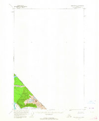
Taku River and its glacial tributaries define this segment of the International Boundary between Alaska and British Columbia. The landscape is dominated by the massive ice fields of West Twin Glacier and East Twin Glacier, which feed into Twin Glacier Lake. High-altitude features like Hades Highway and Ivy Ridge overlook a network of peaks, including Devils Paw and Michaels Sword. Along the riverbanks, scattered cabins and a Gaging Station indicate seasonal human activity and monitoring in the Tongass National Forest. The presence of Canyon Island and various creek systems like Yehring Creek and Moose Creek highlight the drainage patterns through the City and Borough of Juneau as the river moves toward the coast. This 1995 revision provides a detailed view of the evolving glacial margins and remote mountain landmarks in the late twentieth century.
Find a feature on this map
37 named features on this map. Tap any name to fly to it.
Don’t see what you’re looking for? This feature index may not catch every label — zoom into the map to look around manually.
Map Details
Editions of this 1995 Taku River C-6 Map
This is the sole edition of this map. No revisions or reprints were ever made.
Other maps of this area

1948 · Juneau B-1
USGS Topo · 1:63,360

1951 · Juneau
USGS Topo · 1:250,000

1951 · Taku River B-6
USGS Topo · 1:63,360

1951 · Taku River B-5
USGS Topo · 1:63,360

1952 · Juneau B-1
USGS Topo · 1:63,360

1953 · Taku River
USGS Topo · 1:250,000
1960 · Taku River C-5
USGS Topo · 1:63,360

1960 · Taku River C-6
USGS Topo · 1:63,360

1960 · Juneau D-1
USGS Topo · 1:63,360

1960 · Juneau C-1
USGS Topo · 1:63,360