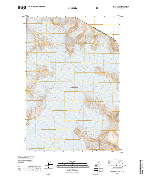
2021 Map of Taku River C-6 NW
USGS Topo · Published 2021About this map
The international border between the United States and Canada cuts across the extreme northeast corner of this high-altitude landscape, where the jagged summit of Devils Paw stands as a prominent landmark. This section of the Tongass National Forest is defined by a series of dramatic glacial features and peaks that shape the surrounding terrain. To the south and east, massive ice fields flow through the mountains, including the East Twin Glacier and Bacon Glacier, which dominate the local hydrology.
Find a feature on this map
15 named features on this map. Tap any name to fly to it.
Don’t see what you’re looking for? This feature index may not catch every label — zoom into the map to look around manually.
Map Details
Editions of this 2021 Taku River C-6 NW Map
This is the sole edition of this map. No revisions or reprints were ever made.
Other maps of this area

1951 · Juneau
USGS Topo · 1:250,000

1953 · Taku River
USGS Topo · 1:250,000

1960 · Taku River C-6
USGS Topo · 1:63,360

1960 · Juneau D-1
USGS Topo · 1:63,360

1960 · Juneau C-1
USGS Topo · 1:63,360

1960 · Taku River
USGS Topo · 1:250,000

1962 · Juneau
USGS Topo · 1:250,000

1995 · Taku River C-6
USGS Topo · 1:63,360
2017 · Taku River C-6 SW
USGS Topo · 1:25,000
2017 · Taku River C-6 NE
USGS Topo · 1:25,000