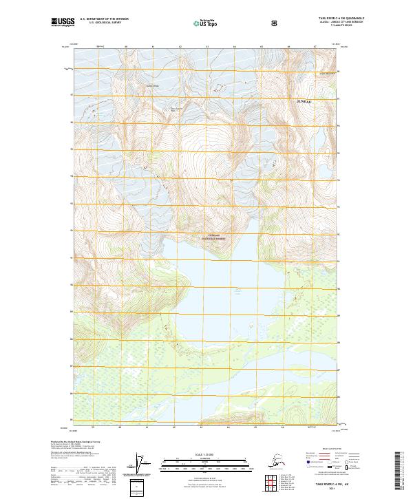
2021 Map of Taku River C-6 SW
USGS Topo · Published 2021About this map
The Coast Mountains dominate this high-latitude terrain within the Tongass National Forest, illustrating a landscape defined by glacial movement and riparian networks. The central basin is occupied by Twin Glacier Lake, which is fed by the surrounding ice masses including the Unknown Glacier. Rising sharply from the valley floor, Twin Glacier Peak and Camp 4 Peak serve as prominent landmarks for navigating this roadless interior. The southern portion of the sheet reveals the braided path of the Taku River, where it intersects with smaller tributaries such as Moose Cr and Johnson Cr. This 2021 survey provides a modern record of the shifting boundaries between ice, water, and forest in the Juneau borough, highlighting the natural drainage patterns that have shaped this portion of the Alaskan panhandle.
Find a feature on this map
17 named features on this map. Tap any name to fly to it.
Don’t see what you’re looking for? This feature index may not catch every label — zoom into the map to look around manually.
Map Details
Editions of this 2021 Taku River C-6 SW Map
This is the sole edition of this map. No revisions or reprints were ever made.
Other maps of this area

1948 · Juneau B-1
USGS Topo · 1:63,360

1951 · Juneau
USGS Topo · 1:250,000

1951 · Taku River B-6
USGS Topo · 1:63,360

1952 · Juneau B-1
USGS Topo · 1:63,360

1953 · Taku River
USGS Topo · 1:250,000

1960 · Taku River C-6
USGS Topo · 1:63,360

1960 · Juneau C-1
USGS Topo · 1:63,360

1960 · Taku River
USGS Topo · 1:250,000

1962 · Juneau
USGS Topo · 1:250,000

1994 · Taku River B-6
USGS Topo · 1:63,360