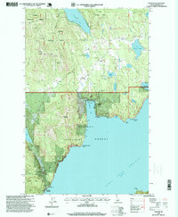
1996 Map of Talache
USGS Topo · Published 1999About this map
Lake Pend Oreille dominates the eastern and southern edges of this area, where the rugged terrain of the Kaniksu National Forest meets the water. The landscape is defined by its mining history, evidenced by the cluster of labels around Talache, including the Talache Mine and the Gold Coin Mine along Bimetallic Ridge. These sites, along with the Mine Dump and Talache Landing, suggest a specialized industrial community that once thrived on the extraction of ore from Prospect Mountain.
Find a feature on this map
42 named features on this map. Tap any name to fly to it.
Don’t see what you’re looking for? This feature index may not catch every label — zoom into the map to look around manually.
Map Details
Editions of this 1996 Talache Map
This is the sole edition of this map. No revisions or reprints were ever made.
Other maps of this area

1901 · Sandpoint
USGS Topo · 1:125,000

1911 · Priest Lake
USGS Topo · 1:250,000

1911 · Sandpoint
USGS Topo · 1:125,000

1913 · Priest Lake
USGS Topo · 1:250,000

1949 · Packsaddle Mtn
USGS Topo · 1:62,500

1951 · Packsaddle Mtn
USGS Topo · 1:62,500

1951 · Elmira
USGS Topo · 1:62,500

1958 · Sandpoint
USGS Topo · 1:250,000

1963 · Sandpoint
USGS Topo · 1:250,000
1968 · Cocolalla
USGS Topo · 1:24,000