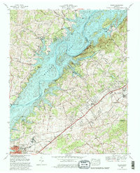
1980 Map of Talbott
USGS Topo · Published 1981About this map
Cherokee Lake dominates this 1980 landscape, its impounded waters following the original course of the Holston River and flooding the lower reaches of Panther Creek. The map documents the region's mid-century modernization, centered on the infrastructure of Cherokee Dam and the development of Panther Creek State Park. To the southeast, the urban growth of Morristown and Jefferson City is visible, linked by the Andrew Johnson Highway and the Southern railway line.
Find a feature on this map
61 named features on this map. Tap any name to fly to it.
Don’t see what you’re looking for? This feature index may not catch every label — zoom into the map to look around manually.
Map Details
Editions of this 1980 Talbott Map
2 editions found
Other maps of this area

1883 · Morristown
USGS Topo · 1:125,000

1893 · Morristown
USGS Topo · 1:125,000

1895 · Morristown
USGS Topo · 1:125,000

1897 · Maynardville
USGS Topo · 1:125,000

1900 · Maynardville
USGS Topo · 1:125,000

1935 · White Pine
USGS Topo · 1:24,000

1935 · Tate Springs
USGS Topo · 1:48,000

1935 · Straw Plains
USGS Topo · 1:48,000

1935 · Joppa
USGS Topo · 1:24,000

1935 · Avondale
USGS Topo · 1:24,000