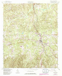
1955 Map of Talbotton
USGS Topo · Published 1986About this map
Talbotton serves as the focal point of this mid-century Georgia survey, positioned at the intersection of a developing road network and the Seaboard Coast Line Railroad. The landscape is defined by the headwaters of numerous waterways, including Lazer Creek and Upatoi Creek, which carve through the terrain surrounding the town. A strong rural community structure is evident in the distribution of local institutions such as Carter Sch and Friendship Ch located just north of the town center.
Find a feature on this map
20 named features on this map. Tap any name to fly to it.
Don’t see what you’re looking for? This feature index may not catch every label — zoom into the map to look around manually.
Map Details
Editions of this 1955 Talbotton Map
2 editions found

Other maps of this area

1907 · Talbotton
USGS Topo · 1:125,000

1934 · Warm Springs
USGS Topo · 1:62,500

1935 · Thomaston
USGS Topo · 1:48,000

1936 · Warm Springs
USGS Topo · 1:62,500

1939 · Thomaston
USGS Topo · 1:62,500

1949 · Upatoi
USGS Topo · 1:24,000

1950 · Talbotton
USGS Topo · 1:24,000

1950 · Geneva
USGS Topo · 1:24,000

1950 · Waverly Hall
USGS Topo · 1:24,000

1950 · Talbotton
USGS Topo · 1:62,500