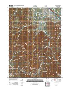
2011 Map of Talent
USGS Topo · Published 2011About this map
Talent serves as the central hub of this Jackson County landscape, where the agricultural legacy of the Rogue Valley is clearly visible through Meyer Orchards, Carter Orchards, and the Cygnet Farm. The intricate irrigation network, including the Talent Middle Canal and Lower East Lateral, illustrates the engineering required to support this fruit-growing region. To the south, the terrain rises sharply into a series of prominent ridges and gaps, including Goat Cabin Ridge, Bull Pine Ridge, and Wagner Gap. Evidence of the area's extraction history is preserved at the Ashland Mine on the eastern edge. Local genealogy and land use history are further grounded by sites like the Stearn Cemetery and several named homesteads such as Brickpile Ranch and Oak Flat tucked along the Little Applegate River.
Find a feature on this map
75 named features on this map. Tap any name to fly to it.
Don’t see what you’re looking for? This feature index may not catch every label — zoom into the map to look around manually.
Map Details
Editions of this 2011 Talent Map
This is the sole edition of this map. No revisions or reprints were ever made.
Other maps of this area

1891 · Ashland
USGS Topo · 1:250,000

1893 · Ashland
USGS Topo · 1:250,000

1897 · Ashland
USGS Topo · 1:250,000

1938 · Medford
USGS Topo · 1:125,000

1954 · Medford
USGS Topo · 1:62,500

1954 · Lakecreek
USGS Topo · 1:62,500

1954 · Talent
USGS Topo · 1:62,500

1954 · Ashland
USGS Topo · 1:62,500

1955 · Medford
USGS Topo · 1:250,000

1957 · Medford
USGS Topo · 1:250,000