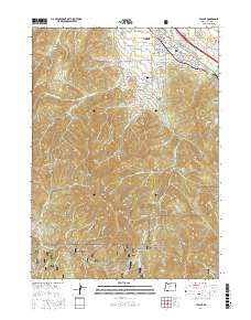
2017 Map of Talent
USGS Topo · Published 2017About this map
Talent serves as the focal point of this map, situated within the fertile valley where Bear Cr and its tributaries meet the rising slopes of the Cascade-Siskiyou foothills. The town’s layout is defined by the intersection of Talent Ave and the Talent Middle Canal, illustrating the importance of early 21st-century irrigation infrastructure for this agricultural region. To the north and east, the Lower E Lateral and Frederick Lateral weave through orchards and homesteads, while the Talent Middle School and Stearn Cem stand as central landmarks for local history and genealogy.
Find a feature on this map
97 named features on this map. Tap any name to fly to it.
Don’t see what you’re looking for? This feature index may not catch every label — zoom into the map to look around manually.
Map Details
Editions of this 2017 Talent Map
This is the sole edition of this map. No revisions or reprints were ever made.
Other maps of this area

1891 · Ashland
USGS Topo · 1:250,000

1893 · Ashland
USGS Topo · 1:250,000

1897 · Ashland
USGS Topo · 1:250,000

1938 · Medford
USGS Topo · 1:125,000

1954 · Medford
USGS Topo · 1:62,500

1954 · Lakecreek
USGS Topo · 1:62,500

1954 · Talent
USGS Topo · 1:62,500

1954 · Ashland
USGS Topo · 1:62,500

1955 · Medford
USGS Topo · 1:250,000

1957 · Medford
USGS Topo · 1:250,000