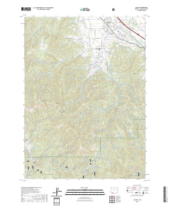
2023 Map of Talent
USGS Topo · Published 2023About this map
Talent and its surrounding agricultural valley are defined by a complex network of irrigation infrastructure and varying topography. The landscape is crisscrossed by essential water systems like the Talent Middle Canal, West Lateral, and McDonald Ditch, reflecting the region's managed water resources for local farming. North of the town, the terrain transitions into the steep ridges of the Rogue River National Forest, where prominent landmarks such as Wagner Butte and Bald Mtn overlook the drainage basins of Anderson Creek and Wagner Creek. Local history is anchored by sites like the Stearn Cem and School House Rd, while the settlement of Oak Flat sits further south near the winding path of the Little Applegate River. Modern transportation corridors like Interstate 5 and Highway 99 follow the natural path of Bear Creek, highlighting how contemporary infrastructure aligns with the historic valley floor.
Find a feature on this map
80 named features on this map. Tap any name to fly to it.
Don’t see what you’re looking for? This feature index may not catch every label — zoom into the map to look around manually.
Map Details
Editions of this 2023 Talent Map
This is the sole edition of this map. No revisions or reprints were ever made.
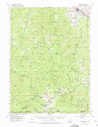
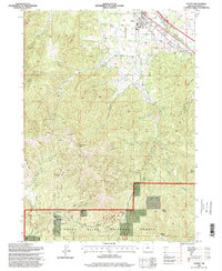
Historical Maps of Talent Through Time
4 maps found