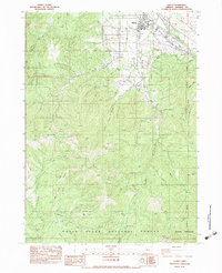
1983 Map of Talent
USGS Topo · Published 1983About this map
Talent sits at the nexus of the Rogue Valley's mid-century transportation and water networks, bounded by the Southern Pacific railroad and the modern Interstate 5. This provisional survey from the early 1980s reveals a landscape defined by the transition from the irrigated orchards of the valley floor to the timbered heights of the Rogue River National Forest. The map documents the intricate system of ditches and siphons necessary for local agriculture, alongside industrial features like the Ashland Mine and various quarries. From the banks of Bear Creek to the high reaches of Wagner Butte, the terrain is deeply etched with historic naming conventions, including numerous gulches and gaps such as Yank Gulch Gap and Bull Pine Gap that once served as vital passage points through the southern Oregon mountains.
Find a feature on this map
53 named features on this map. Tap any name to fly to it.
Don’t see what you’re looking for? This feature index may not catch every label — zoom into the map to look around manually.
Map Details
Editions of this 1983 Talent Map
This is the sole edition of this map. No revisions or reprints were ever made.
Other maps of this area

1891 · Ashland
USGS Topo · 1:250,000

1893 · Ashland
USGS Topo · 1:250,000

1897 · Ashland
USGS Topo · 1:250,000

1938 · Medford
USGS Topo · 1:125,000

1954 · Medford
USGS Topo · 1:62,500

1954 · Lakecreek
USGS Topo · 1:62,500

1954 · Talent
USGS Topo · 1:62,500

1954 · Ashland
USGS Topo · 1:62,500

1955 · Medford
USGS Topo · 1:250,000

1957 · Medford
USGS Topo · 1:250,000