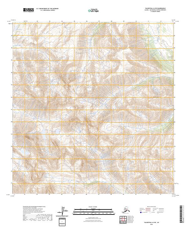
2024 Map of Talkeetna A-6 SW
USGS Topo · Published 2024About this map
Puntilla Mtn dominates this high-altitude landscape in the Matanuska-Susitna Borough, where steep drainage systems define the movement of water through the interior. The hydrology is centered on Puntilla Creek and its lower reaches, Lower Puntilla Creek, which carve through the elevations alongside Canyon Creek. To the north, Gorley Lake sits near the headwaters of these glacial-fed streams. The map reveals a land structured by water and relief, from the prominent Lookout Hill to the complex branching of East Fork Indian Creek and Indian Creek. These drainages serve as the primary landmarks in an area otherwise defined by its sheer topography and the township boundaries of T23N R20W and T24N R19W, illustrating the intersection of natural watersheds with the formal Public Land Survey System.
Find a feature on this map
14 named features on this map. Tap any name to fly to it.
Don’t see what you’re looking for? This feature index may not catch every label — zoom into the map to look around manually.
Map Details
Editions of this 2024 Talkeetna A-6 SW Map
This is the sole edition of this map. No revisions or reprints were ever made.
Other maps of this area

1949 · Tyonek
USGS Topo · 1:250,000

1949 · McGrath
USGS Topo · 1:250,000

1950 · McGrath
USGS Topo · 1:250,000

1950 · Talkeetna
USGS Topo · 1:250,000

1951 · Talkeetna
USGS Topo · 1:250,000

1951 · Tyonek
USGS Topo · 1:250,000

1951 · Lime Hills
USGS Topo · 1:250,000

1958 · Talkeetna A-6
USGS Topo · 1:63,360

1958 · McGrath A-1
USGS Topo · 1:63,360

1958 · Tyonek D-8
USGS Topo · 1:63,360