
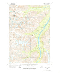
1958 Map of Tyonek D-8
USGS Topo · Published 1963About this map
The Skwentna River dominates this mid-century survey, its braided channels carving through a landscape defined by glacial movements and high peaks. This 1958 field-annotated sheet captures a transitional era of Alaskan surveying where photogrammetric methods from 1957 aerial photography were used to map areas previously marked as unsurveyed by the Bureau of Land Management. Significant ice masses like Stoney Glacier and the Black and Tan Glacier feed into a network of drainages including Muddy Creek and Black and Tan Creek. The terrain is anchored by several prominent summits, including Mount Estelle, Cathedral Mountain, and Mount Stoney, which tower over Portage Pass. This map serves as a primary record of the Seward Meridian's drainage patterns and topographic elevations before later environmental changes altered these alpine and glacial features.
Find a feature on this map
12 named features on this map. Tap any name to fly to it.
Don’t see what you’re looking for? This feature index may not catch every label — zoom into the map to look around manually.
Map Details
Editions of this 1958 Tyonek D-8 Map
2 editions found
Other maps of this area

1949 · Tyonek
USGS Topo · 1:250,000

1949 · McGrath
USGS Topo · 1:250,000

1950 · McGrath
USGS Topo · 1:250,000

1950 · Talkeetna
USGS Topo · 1:250,000

1951 · Talkeetna
USGS Topo · 1:250,000

1951 · Tyonek
USGS Topo · 1:250,000

1951 · Lime Hills
USGS Topo · 1:250,000

1958 · Talkeetna A-6
USGS Topo · 1:63,360

1958 · Tyonek C-8
USGS Topo · 1:63,360

1958 · McGrath A-1
USGS Topo · 1:63,360