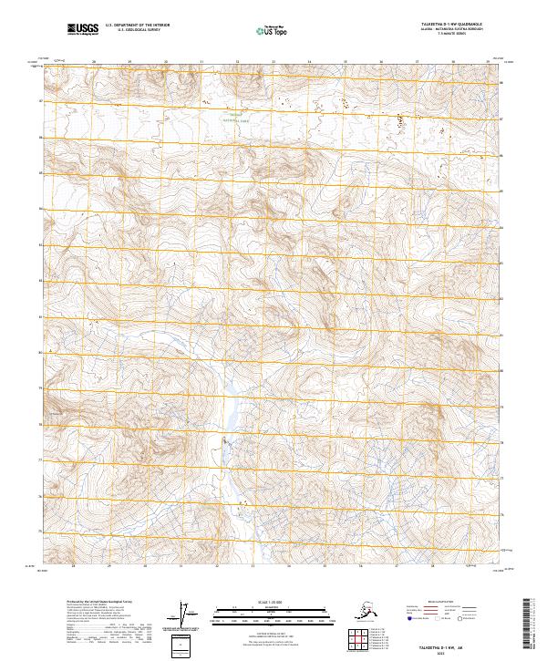
2023 Map of Talkeetna D-1 NW
USGS Topo · Published 2023About this map
Denali National Park encompasses the northern portion of this Alaskan interior landscape, where the high-altitude topography of the Talkeetna Mountains meets the glacial drainages of the Susitna River basin. The Coffee River serves as a primary geographical spine, carving a path southward through steep elevation contours that define the central part of the quadrangle. In the southwestern corner, Mt Mazama stands as a prominent landmark amongst the complex ridgelines. The transition from the protected federal lands of the park to the surrounding territory is marked by the presence of Crystal Creek and several distinct township and range boundaries. This map illustrates a largely roadless wilderness where the natural hydrology of alpine creeks dictates the layout of the land, offering a clear view of the drainage patterns and peaks that characterize this part of the Matanuska-Susitna Borough.
Find a feature on this map
11 named features on this map. Tap any name to fly to it.
Don’t see what you’re looking for? This feature index may not catch every label — zoom into the map to look around manually.
Map Details
Editions of this 2023 Talkeetna D-1 NW Map
This is the sole edition of this map. No revisions or reprints were ever made.
Other maps of this area

1950 · Talkeetna
USGS Topo · 1:250,000

1951 · Talkeetna
USGS Topo · 1:250,000

1952 · Mount McKinley
USGS Topo · 1:250,000

1954 · Mount McKinley A-2
USGS Topo · 1:63,360

1954 · Mount McKinley A-1
USGS Topo · 1:63,360

1958 · Talkeetna D-2
USGS Topo · 1:63,360
1958 · Talkeetna D-1
USGS Topo · 1:63,360

1958 · Talkeetna
USGS Topo · 1:250,000

1958 · Mount McKinley
USGS Topo · 1:250,000

1965 · Talkeetna
USGS Topo · 1:250,000