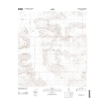
2014 Map of Talkeetna D-2 NE
USGS Topo · Published 2014About this map
Denali National Park and its high alpine wilderness dominate this 2014 survey, highlighting the massive glacial systems and jagged peaks of the Alaska Range. The survey focuses on the upper reaches of the Ruth Glacier, including the expansive Ruth Amphitheater and the dramatic constriction known as The Great Gorge. These features represent a landscape defined by ice movement and sheer vertical relief, where massive formations like Mooses Tooth, Mount Dickey, and Mount Barrille tower over the frozen valleys. To the east, the Buckskin Glacier flows through the high terrain, separated from the Ruth system by a series of prominent summits including Mount Church, Mount Lee, and Mount Glisen. The topography captured here is a study in extreme glacial geography, mapping the exact positions of Pittock Pass and The Gateway during the early 21st century.
Find a feature on this map
22 named features on this map. Tap any name to fly to it.
Don’t see what you’re looking for? This feature index may not catch every label — zoom into the map to look around manually.
Map Details
Editions of this 2014 Talkeetna D-2 NE Map
This is the sole edition of this map. No revisions or reprints were ever made.
Other maps of this area

1950 · Talkeetna
USGS Topo · 1:250,000

1951 · Talkeetna
USGS Topo · 1:250,000

1952 · Mount McKinley
USGS Topo · 1:250,000

1954 · Mount McKinley A-2
USGS Topo · 1:63,360

1954 · Mount McKinley A-1
USGS Topo · 1:63,360

1958 · Talkeetna D-2
USGS Topo · 1:63,360
1958 · Talkeetna D-1
USGS Topo · 1:63,360

1958 · Talkeetna
USGS Topo · 1:250,000

1958 · Mount McKinley
USGS Topo · 1:250,000

1965 · Talkeetna
USGS Topo · 1:250,000