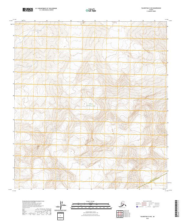
2023 Map of Talkeetna D-4 NE
USGS Topo · Published 2023About this map
Denali National Park dominates this remote interior landscape, where the Swift Fork river cuts through the northwestern corner of the quadrangle. This high-altitude terrain is characterized by steep elevation changes and the preservation of roadless tracts within the Denali Wilderness. The southern reaches of the map highlight the administrative boundary between the Denali Borough Matanuska-Susitna Borough, illustrating the jurisdictional divisions in this vast subarctic environment. Topographic detail here focuses on the natural hydrology and the protected status of the land, providing a specialized look at the park’s northern boundaries where the wilderness remains largely untouched by human infrastructure.
Find a feature on this map
10 named features on this map. Tap any name to fly to it.
Don’t see what you’re looking for? This feature index may not catch every label — zoom into the map to look around manually.
Map Details
Editions of this 2023 Talkeetna D-4 NE Map
This is the sole edition of this map. No revisions or reprints were ever made.
Other maps of this area

1950 · Talkeetna
USGS Topo · 1:250,000

1951 · Talkeetna
USGS Topo · 1:250,000

1952 · Mount McKinley
USGS Topo · 1:250,000

1953 · Mount McKinley A-4
USGS Topo · 1:63,360

1954 · Mount McKinley A-4
USGS Topo · 1:63,360

1954 · Mount McKinley A-3
USGS Topo · 1:63,360

1958 · Talkeetna D-4
USGS Topo · 1:63,360

1958 · Talkeetna D-3
USGS Topo · 1:63,360

1958 · Talkeetna
USGS Topo · 1:250,000

1958 · Mount McKinley
USGS Topo · 1:250,000