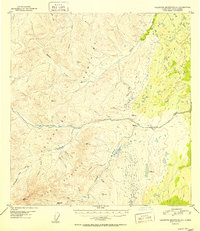
1952 Map of Talkeetna Mountains A-1
USGS Topo · Published 1952About this map
The Talkeetna Mountains and Horn Mountains converge in this high-altitude Alaskan landscape, where the drainage systems of the Little Nelchina River and Tyone Creek define the local topography. This 1952 edition provides a detailed look at the region’s early industrial footprint, specifically highlighting a Placer Mine and the surrounding network of watercourses like Placer Creek and Albert Creek. The presence of such mining activity near Belanger Pass suggests the historical importance of mineral extraction in this portion of the Alaska-Third Judicial Division. Local history and genealogy researchers can use the numerous named peaks and benchmarks, such as VABM Meyer and VABM Albert, to orient themselves within the remote terrain. The map also captures several smaller tributaries, including McDougal Creek, Shovel Creek, and Sleigh Creek, illustrating the complex hydrology of the interior mountains prior to modern development.
Find a feature on this map
25 named features on this map. Tap any name to fly to it.
Don’t see what you’re looking for? This feature index may not catch every label — zoom into the map to look around manually.
Map Details
Editions of this 1952 Talkeetna Mountains A-1 Map
2 editions found
Other maps of this area

1948 · Anchorage D-2
USGS Topo · 1:63,360

1948 · Anchorage D-1
USGS Topo · 1:63,360

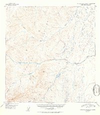
1949 · Talkeetna Mountains A-1
USGS Topo · 1:63,360

1949 · Gulkana A-6
USGS Topo · 1:63,360

1949 · Valdez D-8
USGS Topo · 1:63,360

1950 · Talkeetna Mountains
USGS Topo · 1:250,000

1950 · Gulkana B-6
USGS Topo · 1:63,360

1951 · Gulkana
USGS Topo · 1:250,000

1951 · Anchorage
USGS Topo · 1:250,000

1951 · Anchorage D-1
USGS Topo · 1:63,360