
1954 Map of Tallahassee
USGS Topo · Published 1967About this map
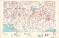
Tallahassee stands as the inland hub of this mid-century survey, surrounded by the expansive timberlands of the Apalachicola National Forest. The landscape is defined by its massive water bodies and river systems, from the sprawling Lake Seminole on the Georgia border to the coastal reaches of St Andrew Bay where Panama City serves as a primary port. The map documents a critical period of infrastructure, showing the Tyndall Air Force Base during the height of the Cold War and the extensive rail networks of the Atlantic Coast Line and Louisville and Nashville railroads.
Find a feature on this map
53 named features on this map. Tap any name to fly to it.
Don’t see what you’re looking for? This feature index may not catch every label — zoom into the map to look around manually.
Map Details
Editions of this 1954 Tallahassee Map
4 editions found
Other maps of this area

1935 · De Funiak Springs
USGS Topo · 1:48,000

1936 · Point Washington
USGS Topo · 1:48,000

1938 · De Funiak Springs
USGS Topo · 1:62,500

1939 · Point Washington
USGS Topo · 1:62,500

1940 · Tallahassee
USGS Topo · 1:62,500

1940 · Arran
USGS Topo · 1:62,500

1942 · Enterprise
USGS Topo · 1:125,000

1942 · Tallahassee
USGS Topo · 1:62,500

1943 · Arran
USGS Topo · 1:62,500

1943 · Beacon Beach
USGS Topo · 1:31,680