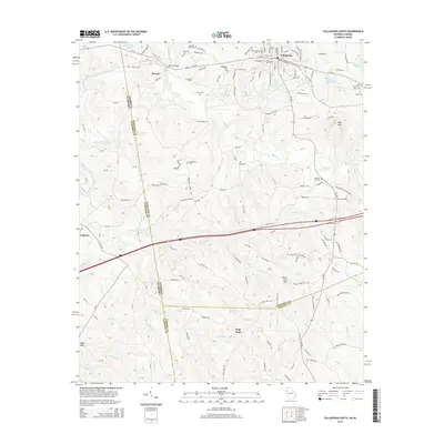
2014 Map of Tallapoosa South
USGS Topo · Published 2014About this map
Tallapoosa serves as the focal point of this Haralson County landscape, situated near the winding course of the Tallapoosa River. The map illustrates a region defined by its numerous family-named landmarks and historical burial grounds, including Laurel Hill Cem, Riverside Cem, and Hollywood Cem clustered near the town center. The terrain transitions into a more rural character toward the state line, marked by significant elevations like High Point and Black Jack Mtn. Smaller settlements such as Hooper and Lebanon are connected by a network of county roads that crisscross creeks like Norman Cr and Williams Cr. The mapping of small water bodies such as Hicks Lake, Godwin Lake, and American Legion Lake reflects the community's local development and land use patterns during the early 21st century.
Find a feature on this map
144 named features on this map. Tap any name to fly to it.
Don’t see what you’re looking for? This feature index may not catch every label — zoom into the map to look around manually.
Map Details
Editions of this 2014 Tallapoosa South Map
This is the sole edition of this map. No revisions or reprints were ever made.
Other maps of this area

1889 · Tallapoosa
USGS Topo · 1:125,000

1892 · Tallapoosa
USGS Topo · 1:125,000

1897 · Tallapoosa
USGS Topo · 1:125,000

1953 · Atlanta
USGS Topo · 1:250,000

1957 · Atlanta
USGS Topo · 1:250,000

1958 · Atlanta
USGS Topo · 1:250,000

1958 · Carrollton
USGS Topo · 1:62,500

1958 · Buchanan
USGS Topo · 1:62,500

1965 · Tallapoosa South
USGS Topo · 1:24,000

1966 · Tallapoosa North
USGS Topo · 1:24,000