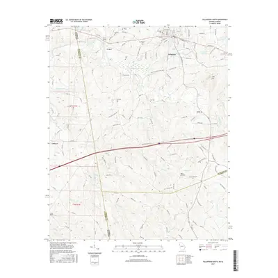
2017 Map of Tallapoosa South
USGS Topo · Published 2017About this map
Tallapoosa serves as the central hub of this West Georgia landscape, situated where the Tallapoosa River winds through the hills of Haralson Co. The town's industrial and transport foundations are visible along the Norfolk Southern rail line and major thoroughfares like the Providence Church Rd. The map documents a dense network of local burial grounds that trace the area's genealogical history, including Riverside Cem, Hollywood Cem, and Laurel Hill Cem near the town center, while more remote sites like Providence Cem and Clay Cem serve outlying communities.
Find a feature on this map
140 named features on this map. Tap any name to fly to it.
Don’t see what you’re looking for? This feature index may not catch every label — zoom into the map to look around manually.
Map Details
Editions of this 2017 Tallapoosa South Map
This is the sole edition of this map. No revisions or reprints were ever made.
Other maps of this area

1889 · Tallapoosa
USGS Topo · 1:125,000

1892 · Tallapoosa
USGS Topo · 1:125,000

1897 · Tallapoosa
USGS Topo · 1:125,000

1953 · Atlanta
USGS Topo · 1:250,000

1957 · Atlanta
USGS Topo · 1:250,000

1958 · Atlanta
USGS Topo · 1:250,000

1958 · Carrollton
USGS Topo · 1:62,500

1958 · Buchanan
USGS Topo · 1:62,500

1965 · Tallapoosa South
USGS Topo · 1:24,000

1966 · Tallapoosa North
USGS Topo · 1:24,000