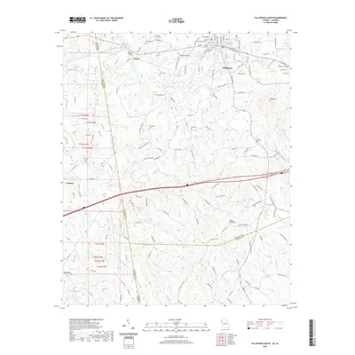
2020 Map of Tallapoosa South
USGS Topo · Published 2020About this map
Tallapoosa serves as the focal point of this region, situated where the Tallapoosa River flows through the northern reaches of the quadrangle. This area is characterized by a high density of small family and community burial grounds, including Riverside Cem, Laurel Hill Cem, and Edgewood Cem, reflecting the deep-rooted settlement patterns of Haralson Co. The landscape is defined by the contrast between the river valley and the elevated terrain of Black Jack Mtn and Tally Mtn. Southwest of the city, the land transitions into a network of creek drainages such as Walker Cr and Kelley Cr. This 2020 edition provides a modern view of the state line between Alabama and Georgia, showing how the early land divisions of t15s r12e and t16s r12e still structure the road networks and property boundaries across Cleburne Co and its neighbors.
Find a feature on this map
144 named features on this map. Tap any name to fly to it.
Don’t see what you’re looking for? This feature index may not catch every label — zoom into the map to look around manually.
Map Details
Editions of this 2020 Tallapoosa South Map
This is the sole edition of this map. No revisions or reprints were ever made.
Other maps of this area

1889 · Tallapoosa
USGS Topo · 1:125,000

1892 · Tallapoosa
USGS Topo · 1:125,000

1897 · Tallapoosa
USGS Topo · 1:125,000

1953 · Atlanta
USGS Topo · 1:250,000

1957 · Atlanta
USGS Topo · 1:250,000

1958 · Atlanta
USGS Topo · 1:250,000

1958 · Carrollton
USGS Topo · 1:62,500

1958 · Buchanan
USGS Topo · 1:62,500

1965 · Tallapoosa South
USGS Topo · 1:24,000

1966 · Tallapoosa North
USGS Topo · 1:24,000