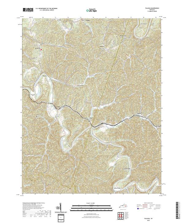
2022 Map of Tallega
USGS Topo · Published 2022About this map
The Middle Fork Kentucky River and the North Fork Kentucky River carve through the landscape of the Cumberland Plateau, defining the settlement patterns and travel corridors for this corner of Kentucky. Small communities like Tallega, Athol, and Canyon Falls are linked by the winding courses of State Hwy 708 and State Hwy 2017, which navigate the steep topography between ridges. Local history is anchored by family and community landmarks such as Palmer Cem and the prominent Anvil Knob. This 2022 survey captures the jurisdictional meeting point of Lee, Breathitt, and Owsley counties, where remote hamlets like Jetts Creek and Lone still reflect a landscape shaped by river bends and deep hollows.
Find a feature on this map
27 named features on this map. Tap any name to fly to it.
Don’t see what you’re looking for? This feature index may not catch every label — zoom into the map to look around manually.
Map Details
Editions of this 2022 Tallega Map
This is the sole edition of this map. No revisions or reprints were ever made.
Other maps of this area

1889 · Salyersville
USGS Topo · 1:125,000

1891 · Manchester
USGS Topo · 1:125,000

1891 · Hazard
USGS Topo · 1:125,000

1891 · Salyersville
USGS Topo · 1:125,000

1892 · Beattyville
USGS Topo · 1:125,000

1899 · Salyersville
USGS Topo · 1:125,000

1913 · Buckhorn
USGS Topo · 1:62,500

1951 · Landsaw
USGS Topo · 1:24,000

1951 · Jackson
USGS Topo · 1:24,000

1952 · Tallega
USGS Topo · 1:24,000