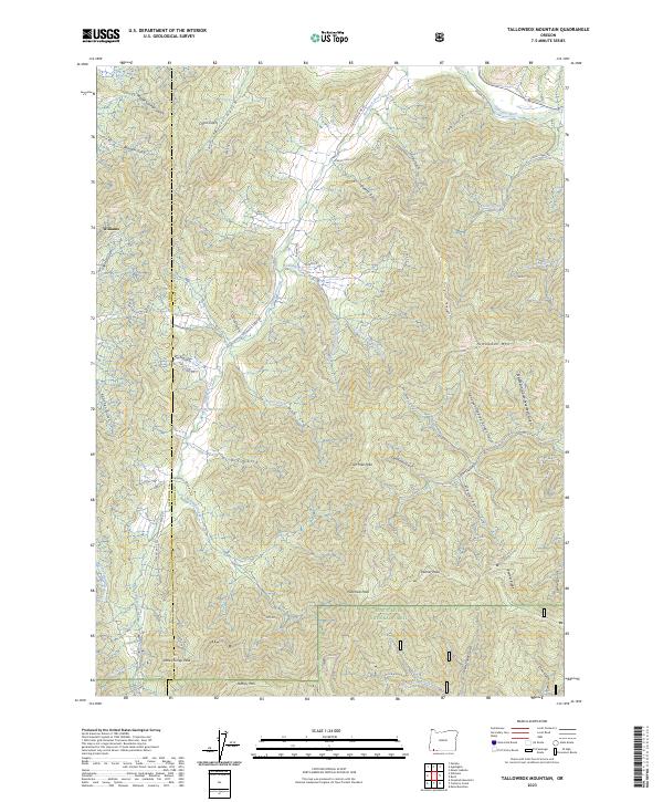
2023 Map of Tallowbox Mountain
USGS Topo · Published 2023About this map
Tallowbox Mtn and the surrounding peaks of the Rogue River National Forest dominate this landscape along the border of Josephine and Jackson counties. The area is defined by a dense network of gulches and creeks, including the winding Thompson Creek and Star Gulch, which feed into the northern drainage of the Applegate River. Small-scale water management is evident through features like Kinworthy Reservoir and Brown Res, supporting the localized settlement of Williams in the northwest corner.
Find a feature on this map
63 named features on this map. Tap any name to fly to it.
Don’t see what you’re looking for? This feature index may not catch every label — zoom into the map to look around manually.
Map Details
Editions of this 2023 Tallowbox Mountain Map
This is the sole edition of this map. No revisions or reprints were ever made.
Other maps of this area

1908 · Grants Pass
USGS Topo · 1:125,000

1954 · Oregon Caves
USGS Topo · 1:62,500

1954 · Gold Hill
USGS Topo · 1:62,500

1954 · Grants Pass
USGS Topo · 1:62,500

1954 · Ruch
USGS Topo · 1:62,500

1955 · Medford
USGS Topo · 1:250,000

1957 · Medford
USGS Topo · 1:250,000

1958 · Medford
USGS Topo · 1:250,000
1983 · Mt. Isabelle
USGS Topo · 1:24,000
1983 · Squaw Lakes
USGS Topo · 1:24,000