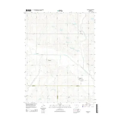
2014 Map of Talmage
USGS Topo · Published 2014About this map
Little Nemaha River and its multiple forks define the landscape of southeastern Nebraska where Otoe, Johnson, and Nemaha counties meet. The settlement of Talmage serves as a local hub near the confluence of the N Fork Little Nemaha River and the main channel, showing a clear grid of streets including Main St and Market St. To the north, the village of Lorton sits along the North Fork, while the community of Tangeman is situated further west along Co Road 40. This era is characterized by an extensive network of water management, evidenced by numerous numbered reservoirs such as Wilson Cr Reservoir 3-6 and Little Nemaha River Reservoir 3-1B. For genealogists, the map preserves the locations of several burial grounds, including Grant Evergreen Cem and Biggs Cem, which are scattered throughout the agricultural uplands.
Find a feature on this map
55 named features on this map. Tap any name to fly to it.
Don’t see what you’re looking for? This feature index may not catch every label — zoom into the map to look around manually.
Map Details
Editions of this 2014 Talmage Map
This is the sole edition of this map. No revisions or reprints were ever made.
Other maps of this area

1903 · Weeping Water
USGS Topo · 1:125,000

1907 · Nebraska City
USGS Topo · 1:62,500

1915 · Howe
USGS Topo · 1:62,500

1929 · Weeping Water
USGS Topo · 1:125,000

1955 · Nebraska City
USGS Topo · 1:250,000

1955 · Lincoln
USGS Topo · 1:250,000

1957 · Nebraska City
USGS Topo · 1:250,000

1957 · Lincoln
USGS Topo · 1:250,000

1958 · Lincoln
USGS Topo · 1:250,000

1958 · Nebraska City
USGS Topo · 1:250,000