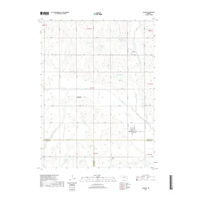
2017 Map of Talmage
USGS Topo · Published 2017About this map
Talmage serves as the primary hub of this Otoe County landscape, where the confluence of several local waterways dictates the rural development pattern. The North Fork Little Nemaha River and South Fork Little Nemaha River wind through the terrain, flanked by numerous flood-control structures such as Wilson Cr Reservoir 3-6 and Spring Cr Reservoir 3-1. This network of reservoirs highlights the region's managed agricultural environment. Small settlements like Lorton and Tangeman are linked by a grid of county roads, including Co RD 46 and N RD. For those tracing local heritage, the map identifies several distinct burial grounds, notably Biggs Cem and Grant Evergreen Cem. The placement of these cemeteries, often near smaller tributaries like Jones Cr or Spring Cr, provides a clear view of the historical community distribution across the Nebraska plains.
Find a feature on this map
61 named features on this map. Tap any name to fly to it.
Don’t see what you’re looking for? This feature index may not catch every label — zoom into the map to look around manually.
Map Details
Editions of this 2017 Talmage Map
This is the sole edition of this map. No revisions or reprints were ever made.
Other maps of this area
1903 · Weeping Water
USGS Topo · 1:125,000
1907 · Nebraska City
USGS Topo · 1:62,500
1915 · Howe
USGS Topo · 1:62,500
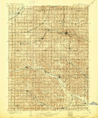
1929 · Weeping Water
USGS Topo · 1:125,000
1955 · Nebraska City
USGS Topo · 1:250,000
1955 · Lincoln
USGS Topo · 1:250,000
1957 · Nebraska City
USGS Topo · 1:250,000
1957 · Lincoln
USGS Topo · 1:250,000
1958 · Lincoln
USGS Topo · 1:250,000
1958 · Nebraska City
USGS Topo · 1:250,000