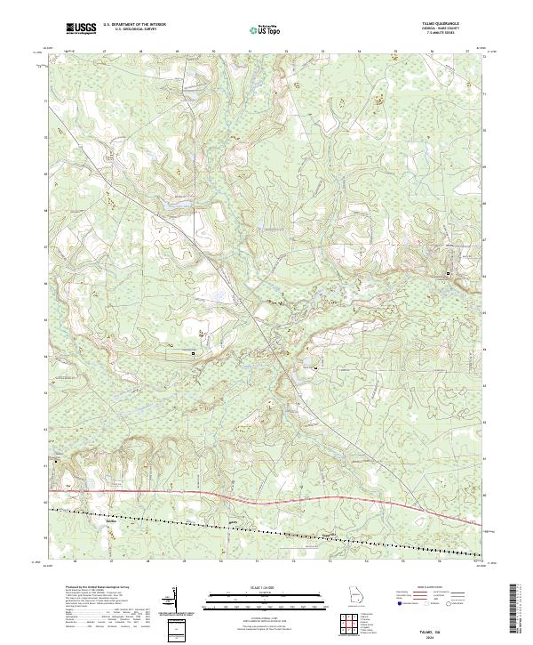
2024 Map of Talmo
USGS Topo · Published 2024About this map
Fairfax, Hasty, and Sappville anchor the southern landscape of this Ware County territory, where a complex network of wetlands and river systems defines the topography. The Satilla River and Seventeen Mile River converge here, joined by tributaries such as Fullwood Creek and Pullwood Creek. This hydraulic environment is characterized by wide floodplains and distinctive terrain features like Big Bens Den, reflecting the natural drainage patterns of South Georgia's coastal plain.
Find a feature on this map
69 named features on this map. Tap any name to fly to it.
Don’t see what you’re looking for? This feature index may not catch every label — zoom into the map to look around manually.
Map Details
Editions of this 2024 Talmo Map
This is the sole edition of this map. No revisions or reprints were ever made.
Other maps of this area

1953 · Waycross
USGS Topo · 1:250,000

1958 · Waycross
USGS Topo · 1:250,000

1967 · Waycross West
USGS Topo · 1:24,000

1967 · Pine Valley
USGS Topo · 1:24,000

1968 · Cogdell
USGS Topo · 1:24,000

1971 · Dixie Union
USGS Topo · 1:24,000

1971 · Wilsonville
USGS Topo · 1:24,000

1971 · Beach
USGS Topo · 1:24,000

1971 · Axson
USGS Topo · 1:24,000

1971 · Talmo
USGS Topo · 1:24,000