
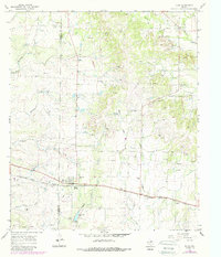
1967 Map of Talpa
USGS Topo · Published 1969About this map
Talpa serves as the focal point of this mid-century landscape in Coleman County, where the Atchison Topeka and Santa Fe railroad cuts across the southern plains. The settlement is anchored by local infrastructure including the Talpa City Lake and the Talpa Cem, reflecting a community deeply tied to its geography. To the northeast, Glen Cove is defined by its own cemetery and the Glen Cove Pumping Sta, highlighting the area's development around water and transportation networks.
Find a feature on this map
28 named features on this map. Tap any name to fly to it.
Don’t see what you’re looking for? This feature index may not catch every label — zoom into the map to look around manually.
Map Details
Editions of this 1967 Talpa Map
2 editions found
Other maps of this area

1892 · Ballinger
USGS Topo · 1:125,000

1932 · Voss
USGS Topo · 1:62,500

1932 · Paint Rock
USGS Topo · 1:62,500

1954 · Brownwood
USGS Topo · 1:250,000

1967 · Novice West
USGS Topo · 1:24,000
1967 · Little Grape Creek
USGS Topo · 1:24,000
1967 · Novice East
USGS Topo · 1:24,000
1967 · Valera
USGS Topo · 1:24,000
1967 · Buffalo Bluff
USGS Topo · 1:24,000
1967 · Benoit
USGS Topo · 1:24,000